A Tax Code Area (TCA), or Taxing Authority Group (TAG), is a unique combination of overlapping taxing districts. Each TCA is given a levy rate based on the taxing districts it encompasses; property tax is calculated by multiplying the assessed value of the property by the levy rate.
A TCA does not need to be contiguous and can occur separately in various parts of a county. However, TCAs only occur within a single county’s boundaries; the same TCA number found in different counties are referencing a different combination of taxing district.
Example:
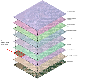
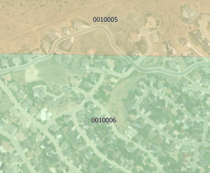
Below is a visual representation of a subsection of TCA 001-0006 in eastern Boise, Ada County. TCA 001-0006 contains 8 taxing districts that overlap in space. If we were to travel slightly north, we would be outside of Boise Auditorium’s boundary and thus be within TCA 001-0005.
NOTE: TCA 001-0006 in Elmore County (or any county other than Ada) does not contain any of the same districts as below.